What if you could "see" a moment in history, one that's been leveled, paved over, developed and otherwise obscured by the present day?
A digital scholarship project is unearthing just such an event: The Battle of Atlanta. The Civil War battle, which took place in July 1864 largely in the southeastern quadrant of the city, today is hidden by service stations, highways and streets, traffic islands, flattened hills and unmarked spots of significance.
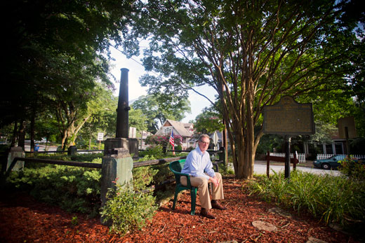
"People can't easily retrace the Battle of Atlanta because it doesn't exist as a battlefield park or monument. But it was significant for greatly improving the odds for Abraham Lincoln's re-election," says Allen Tullos, professor of history and co-director of the Emory Center of Digital Scholarship (ECDS), which is facilitating the project.
The goal of Digital Atlanta: Mapping the Battle is to build a multimedia essay about the battle with accompanying maps and images for the Emory-based digital journal Southern Spaces. A free mobile phone "app" will also allow you take a tour of the historic sites on your own.
Mapping the Battle is one of several projects being created through the Digital Scholarship Commons (DiSC), now part of the ECDS. Funded with a grant from the Andrew W. Mellon Foundation, ECDS assists faculty members and graduate students in developing multidisciplinary projects using digital technology.
Civil War sites are scattered throughout Atlanta, including a hill at The Carter Center where Gen. William Sherman watched the battle as it unfolded, and Alonzo Crim High School, where significant fighting occurred. Near the school is another historic spot, where Union Gen. James McPherson was killed.
"Most people pass these sites every day or they drive within a hundred yards of where there is a site and they don't realize it. So we're trying to put you in a location so you can park your car, and learn about what took place," Tullos explains.
The digital scholarship team has recorded GPS coordinates for each stop on the tour. The entire tour will take four hours, but you can start, stop or re-start at any point. Guided by an interactive map, you can look at photographs, watch a short video and read a description of what happened at each site.
Touring via mobile
Jay Varner, an operating systems administrator in the Woodruff Library, is creating the infrastructure for the mobile tour. "It's not really going to be an app where you go to the app store and download it," he explains, "It's a mobile optimized website that you open up your browser and go to [on your smartphone]."
There will also be a set of driving directions. "You'll be able to open up the map in your phone's mapping application to see where you are, and get directions to the next place," he says.
In the future, the Emory Center for Digital Scholarship plans to take the code used in running this site to create other tours as well. "I'm building this in a way that will make it easy to re-use," Varner says, "for any projects that have content and locations that you want to put together."
Using his phone, Varner shows a map with "balloons" marking the 12 tour stops. On the site, he says, users will find two different versions of the tour. One is a full version offering lengthier text about what happened at the site and the other will have a briefer version. You'll be able to swipe through a series of related images, too, he says, garnered from Emory's Manuscript, Archives, Rare Book Library, the Atlanta History Center, and the Atlanta Journal-Constitution.
The text describing points of interest along the tour and information for each one, plus some of the images, are provided courtesy of Daniel Pollock, a Battle of Atlanta scholar and physician who works at the nearby Centers for Disease Control and Prevention (CDC).
Pollock's extensive knowledge about the Battle is the primary source of information for the video and the text that will appear on Southern Spaces, and on the tour that will be accessed on mobile devices. "The idea is to try and understand what the topography was like, what conditions were like for people in the battle," says Tullos, who is also senior editor for Southern Spaces.
History graduate student Chris Sawula has been culling regimental histories, journals and diaries as well as photographs and newspaper clippings. Emory librarian Erica Bruchko has also helped assemble an index of Atlanta History Center documents.
"We're trying to make it not just about soldiers, but about the social significance, the different conditions people were living in and what happens after the Battle of Atlanta, including the later phenomenon of soldiers' reunions. So it will have a beginning, a detailed content part, and an aftermath," Tullos says. "We are trying as well to include the perspectives of African Americans and women."
The hope is once the digital map and essay are published on Southern Spaces and discovered, visitors might have materials of their own, scrapbooks or documents that they could share.
Tullos says the goal is to get a test version of the project developed for Southern Spaces by January. "Then try that out, and have the real thing before the Battle anniversary, the sesquicentennial of which is July 2014."
That's the past and the present. What about the future?
Tullos makes a wish for a 3D virtual version of the Battle of Atlanta.
"If you had the ability to create a virtual spatial representation of the Battle topography, that would allow visitors to better understand the difficulties of Atlanta's terrain at that time, and to better understand how this historical event played out."